Dodging deluges
The defining feature of a sign mounted more than six feet off the ground at the entrance to the Warwick Sewer Authority is a thick black line bordered in red.
“HIGH WATER MARK,” the sign reads, above the date March 31, 2010. “DURING THE GREAT FLOOD OF 2010, WATER FROM THE PAWTUXET RIVER ROSE TO THIS LEVEL AT THIS LOCATION.”
Back then, the earthen berm around the plant that treats all of the wastewater for this city of 81,000 people stood 18 feet high. It was designed to provide three feet of clearance from floodwaters in a 100-year storm, one that has a 1 percent chance of happening in any given year.
Two weeks earlier, after a pair of rainstorms in quick succession, the Pawtuxet, which lies just on the other side of the berm, had reached record flood levels. It threatened to reach the top of the berm, but stopped a few feet short.
Then another storm hit on March 29, dumping 8.8 inches of rain on Warwick over the next 24 hours. Around lunchtime on March 30, the Pawtuxet began pouring over the berm that runs nearly half a mile long and encloses the treatment plant.
The area started filling up like a giant bathtub.
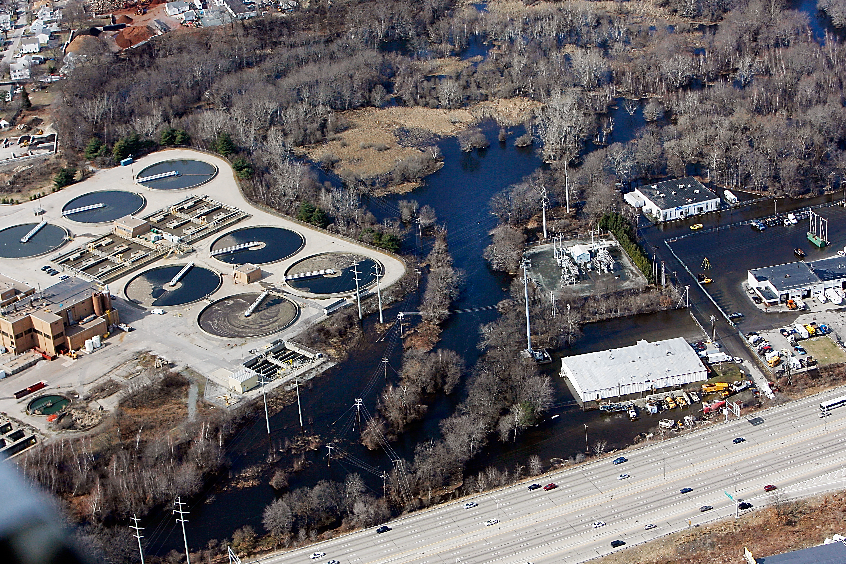
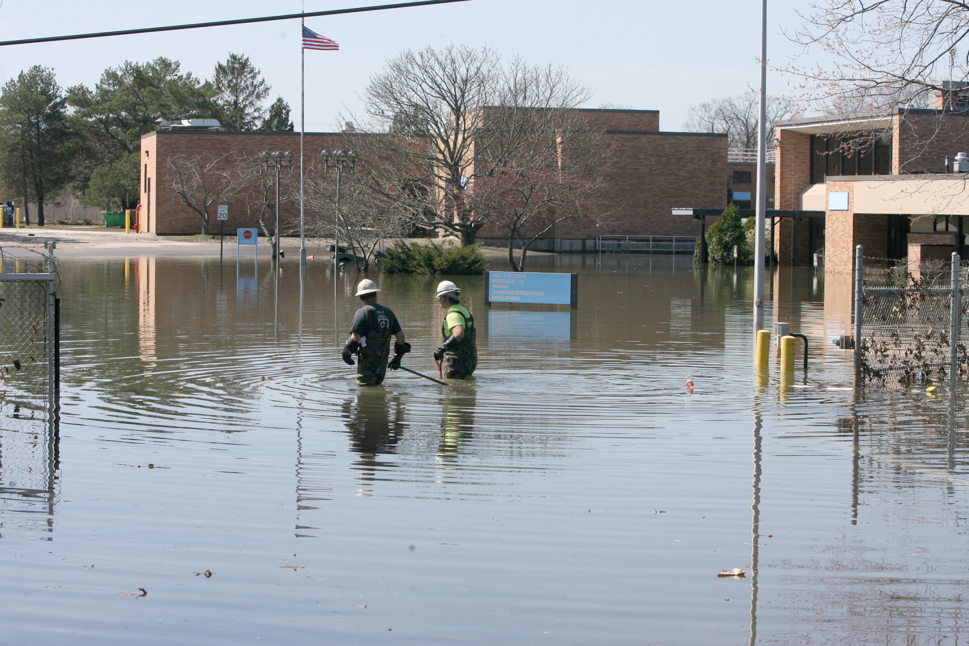
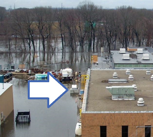
The Pawtuxet crested the next day at nearly 21 feet, more than double its flood-stage elevation. The treatment plant was submerged by an estimated 75 million gallons of dirty stormwater and raw sewage.
For five days, the plant was out of commission. Everything that went through it emptied, untreated, into the Pawtuxet and on into Narragansett Bay.
When the plant came back on line, it was at a rudimentary level only. It would take three months before the plant returned to full operation — a quick turnaround considering the damage, says Janine Burke-Wells, director of the sewer authority at the time.
The floods hit the treatment plant in Warwick harder than any other in Rhode Island, but it wasn’t alone. The West Warwick treatment plant completely flooded and was forced to shut down, too, sending millions more gallons of sewage into the Pawtuxet. The same thing happened in Cranston after part of its plant flooded, as well as three pump stations in the city, cutting off connections to hundreds of homes. The Bristol and Westerly plants also experienced some flooding.
Other plants that may not have been damaged were overwhelmed by the amount of runoff flowing into their systems from roadside storm drains. Full to capacity, they spilled contaminated water into streets and basements.
The historic floods were a wake-up call for Rhode Island’s wastewater treatment plants, raising alarms about threats that are expected to grow more serious as the climate changes: more frequent extreme rainstorms that will tax the capacities of decades-old systems and increase the chances of inland flooding, and, for plants on the coast, rising sea levels that will cause more damaging storm surges.
Burke-Wells, who now heads up a biosolids industry group, never expected something like the 2010 floods. But now, she doesn’t know if something worse could come. As she speaks one recent afternoon, a steady rain is falling.
“I get a little PTSD on days like this,” she says.
Chances are that when you flush your toilet, you don’t think about what happens to the contents. But the 19 major treatment plants in Rhode Island perform an essential function in cleaning up 120 million gallons of wastewater every day so it can be released safely back into the water cycle with minimal impact on the environment.
Wastewater treatment is what stands between a morning raking for quahogs in Narragansett Bay and a ban on shellfishing, or an afternoon at Oakland Beach and a closure because of excess bacteria.
If there are any doubts about the effects of wastewater operations on the Rhode Island environment, consider the changes in the Bay, the state’s iconic natural resource, since the Department of Environmental Management enacted new standards for treatment plants in 2003. Levels of nitrogen and phosphorous — nutrients that can cause fish-killing low-oxygen conditions — are down by half. Bacteria counts have dropped by the same amount after the completion of a tunnel under Providence to store and treat polluted runoff.
The Bay is cleaner and clearer now than it has been in generations — largely because of better treatment of sewage and stormwater.
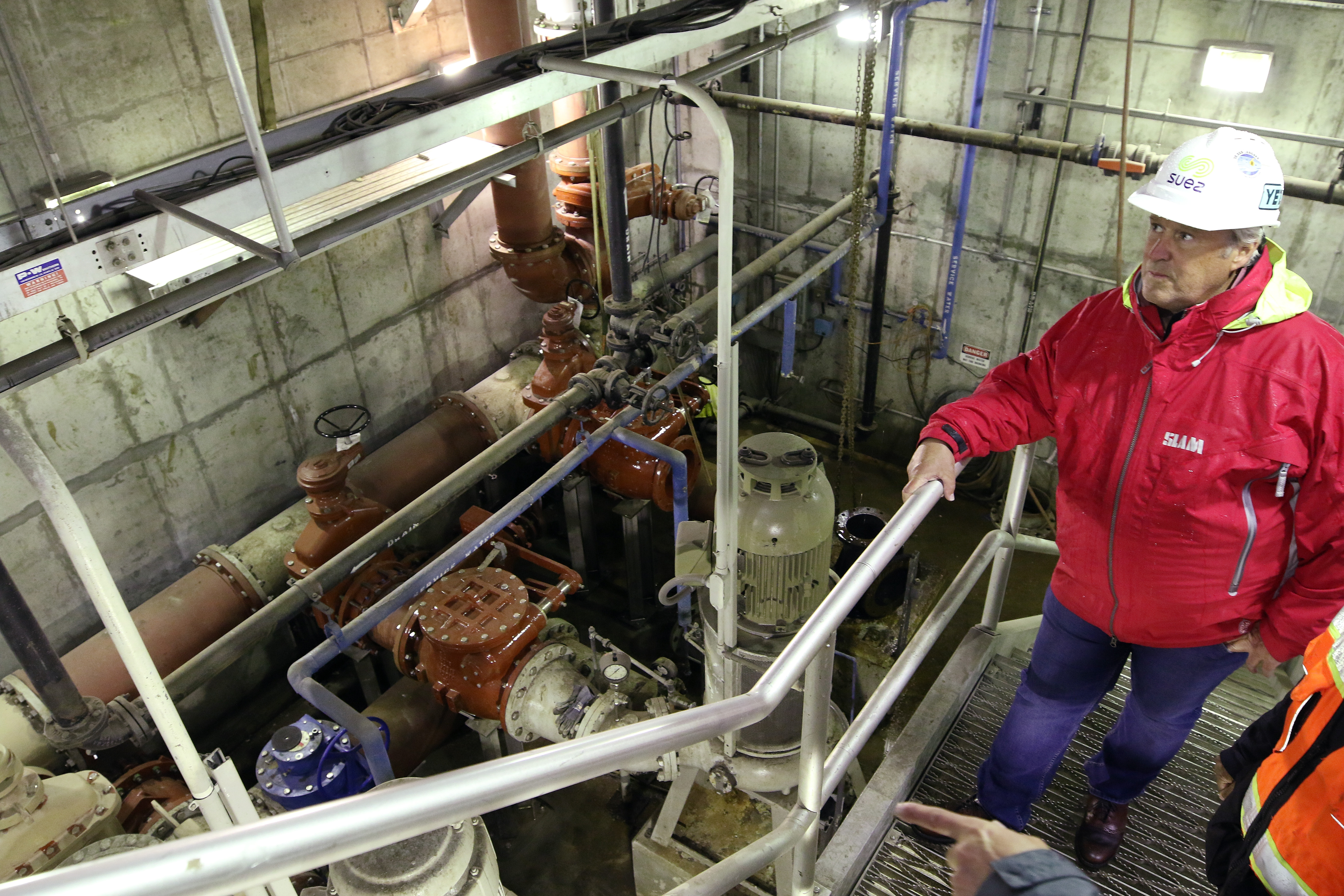
Modern treatment plants are marvels of engineering, employing a combination of screens, pumps, tanks, chemicals and microorganisms to do their job. They are complex and expensive.
And they are arguably more vulnerable to the impacts of climate change than any other class of infrastructure.
As a rule, treatment plants are located on low-lying land, so that the force of gravity can be maximized to pull wastewater to them through underground sewer pipes. They must be near a waterway in which they can discharge treated water, which means they have almost always been built in coastal or river flood plains.
Of the 19 large plants in the state, seven would be predominantly flooded in the event of a 100-year storm, according to a 2017 report from the DEM and the Executive Climate Change Coordinating Council.
Nearly all of the most vulnerable plants are found on the coast, including the Fields Point plant in Providence and the Bucklin Point plant in East Providence — the two biggest treatment plants in Rhode Island, which together serve the greater Providence area and the Blackstone Valley — as well as plants in East Greenwich and at Quonset Point in North Kingstown.
Another seven would be partially flooded. They include the plants in Burrillville, Newport and Woonsocket.
For other plants, such as one in Jamestown, floodwaters would inundate access roads. And in some communities, Newport and Westerly among them, pump stations, which are critical to delivering wastewater to treatment plants, would flood and potentially fail, meaning whole areas of a community would lose service.
After nearly two decades studying the links between rainfall and river flows, David Vallee saw his world change on March 29, 2010, as he forecast the coming floods in Rhode Island.
“That was my religious experience,” he says. “That’s when it dawned on me. This ain’t like what it used to be.”
Vallee, a Rhode Island native, is the hydrologist-in-charge at the Northeast River Forecast Center in Norton, Massachusetts, one of 13 such centers operated by the National Weather Service around the country.
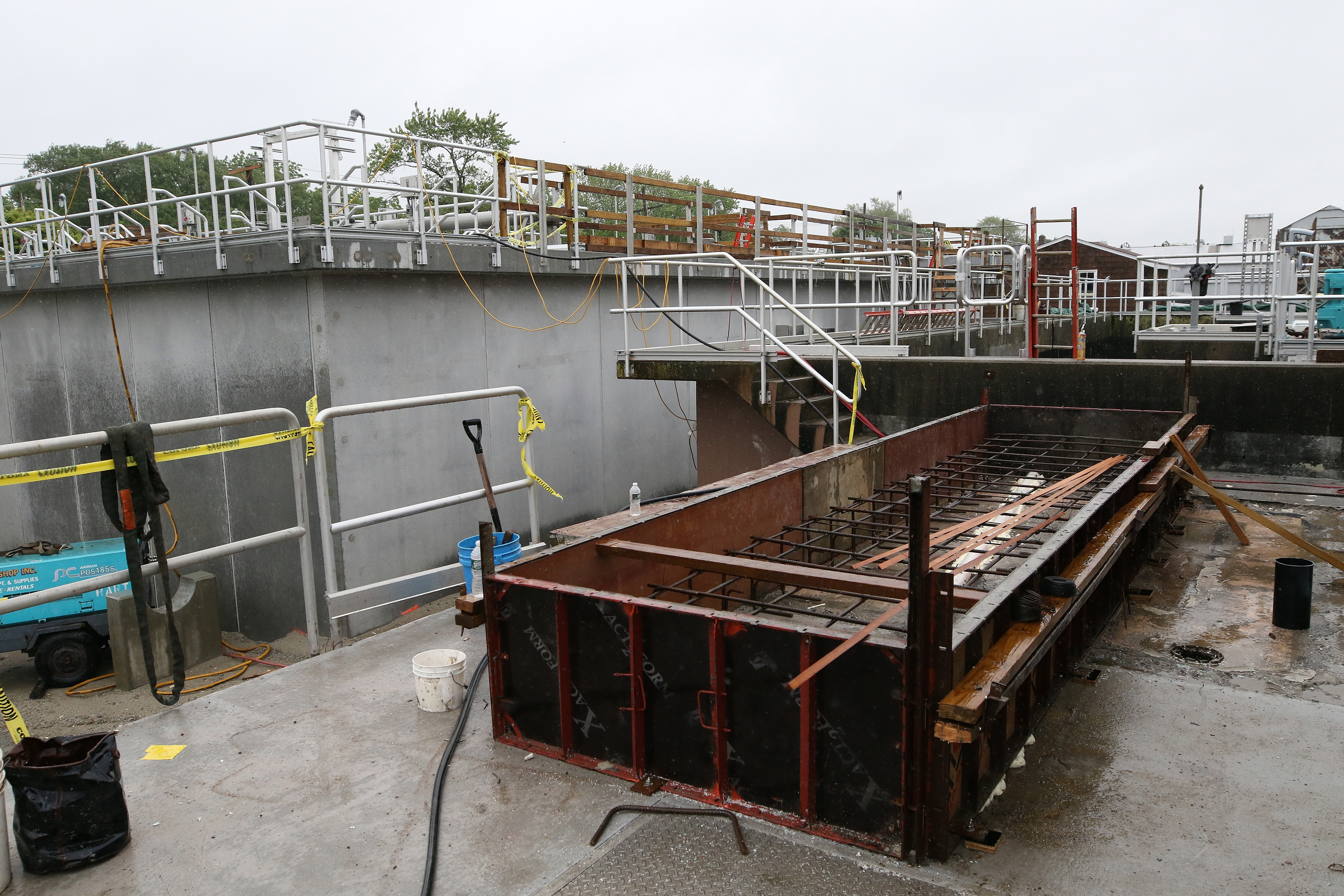
He is speaking on a spring morning to a couple of dozen wastewater-treatment plant operators at an extreme-weather training session hosted by the New England Interstate Water Pollution Control Commission, which started offering seminars like this after Superstorm Sandy in 2012. They are meeting in the conference room at the Warwick Sewer Authority, which was gutted and rebuilt after the 2010 floods.
Vallee explains that the river center has developed water-flow models for different watersheds based on rainfall, soil moisture and other factors, using historical data that in some locations goes back to the 1920s. Over the past decade or so, the predictions in the models have fallen short of reality, and the center is being forced to recalibrate them.
“There’s been that dramatic a shift in the amount of rain, how it rains, the fact that we get stuck in these intense, crazy ruts where we get whacked three or four times in a row,” he says. “The whole dynamic has changed.”
The change is driven by a variety of factors that include a slowdown in the jet stream, the interplay between tropical and temperate weather systems, and warming oceans. The 2010 floods — caused by four major rainstorms in five weeks — exemplified the shift. So too, says Vallee, did Hurricanes Harvey, which hit Texas two years ago, and Florence, which hammered the Carolinas last year, both big, slow-moving storms.
In Rhode Island, annual precipitation is increasing by about an inch a decade. Last year was the third-wettest on record for the state. Rainfall is becoming more concentrated in shorter windows in the spring and fall. And extreme rainfall events are also becoming more frequent. In the 1930s, T.F. Green Airport typically recorded seven or eight one-inch rain events a year. There were 22 in 2018.
The wetter weather is evident in the Scituate Reservoir, which was designed in the 1920s to fill up with water by June 1 for peak demand in the summer. In recent years, the reservoir has been full by February or March, Vallee says.
What does all this mean for wastewater-treatment plants? For one, they are at greater risk of flooding, especially when sea-level rise, which has totaled about 10 inches at the Newport tide gauge since 1930, is factored in.
But it also means that the risk of their systems becoming overwhelmed by stormwater is growing.
Vallee points to circa-1960s federal standards that guided the design of much of the water infrastructure still in use today. The criteria required that they be able to handle as much as seven inches of rainfall in a 24-hour period, the maximum estimate for a 100-year storm.
When the standards were updated two years ago, the number was raised to eight inches.
“We’ve under-designed for today’s new normal,” he says.
In a way, planning ahead is an exercise in imagination.
“Look at your plants,” DEM principal engineer Bill Patenaude tells the people at the training session in Warwick, “and think, ‘What would happen if?’”
When Patenaude, the DEM’s point person on treatment operations, and others worked on the 2017 report on climate change risks, they didn’t use flood maps created by the Federal Emergency Management Agency, which are the nationwide standard but are based only on the historical record. Instead, the report relied on future flooding projections developed by the University of Rhode Island and the Rhode Island Coastal Resources Management Council.
Using their estimates, the report came up with 275 projects to enhance protections spread across the 19 plants. About 150 would cost less than $50,000 and another 100 would be no more than $250,000.
Patenaude likes to use a photo taken during the 2010 floods of the Cranston treatment plant to explain how small projects can make a big difference. The picture shows a small wall built a few years earlier holding back floodwaters from entering an access hatch to an underground tunnel full of expensive electrical equipment.
“It’s a small city down there, and if water had gotten in there, it would have been a disaster,” Patenaude says. “Tens of thousands of dollars protected millions of dollars.”
There are two general ways that treatment plants can be protected: by building walls or raising equipment.
The West Warwick Regional Wastewater Treatment Facility doesn’t have the room to build a levee, so after the 2010 floods the plant improved the backup power system by elevating generators. It also upgraded them so they can now power the entire plant if there’s an outage.
The Warwick Sewer Authority, meanwhile, spent $3 million to add another 5½ feet to its berm, high enough to protect the treatment plant from a 500-year storm. If the 2010 floods happened today, the plant would remain dry.
But as to the future, Burke-Wells isn’t so sure that it will not flood again.
“I would never say never,” she says. “We’re designing to standards of today. If we keep going down this path, those numbers will no longer be valid.”
To keep up with the shifting numbers, the DEM now requires treatment plants to account for climate-change projections when they design upgrades or expansions. Some communities have already done so.
The Narragansett Wastewater Division incorporated sea-level rise estimates into protections for its treatment plant, near the Atlantic Ocean just south of Scarborough State Beach. After the surge from Superstorm Sandy in 2012 reached the plant's grounds — the first time something like that had happened — town officials moved to enhance protections. The $1.5-million steel-and-boulder wall around the plant, completed in 2017, is designed against a 100-year storm plus the projected sea level rise over 50 years.
Warren is in the midst of a project that also aims to take future changes into account. It’s impossible to build a levee around its treatment plant on the Warren River, but as part of $21.7 million in improvements, the town is raising aeration tanks to a height of 21 feet, moving all electrical equipment up, installing waterproof motors, and sealing off doors, all with the aim of protecting everything from a 100-year storm and three feet of sea level rise.
As for the Fields Point and Bucklin Point wastewater treatment facilities, this past academic year, seniors in the ocean engineering department at the University of Rhode Island assessed them and found weaknesses at both.
The Fields Point plant would remain well above rising seas in the coming decades, but it flooded in both the Hurricane of 1938 and Hurricane Carol in 1954, and a surge from a 100-year storm would knock down nearly all of its treatment systems. There’s no room for a berm around the plant, but there may be space for a concrete wall, the students concluded.
Protecting the Bucklin Point plant from a storm surge could also pose a challenge. The existing berm around it was raised to 20.5 feet in 2014, but it’s still not high enough to withstand the surge from a 100-year storm. If the berm were overtopped, the whole plant would flood, just like what happened to Warwick in 2010.
“Water depth would be 10+ feet at center driveway,” the DEM report says.
There will come a time when some treatment plants won’t be able to add more protections or the costs will become too high. If a plant was built for $20 million, then spending $50 million to protect it makes no sense. It may also be untenable to stay in operation if flooding becomes frequent.
And the reality is that even if a treatment plant takes steps to increase protections, there are other factors outside of its control.
In Jamestown, parts of the wastewater system are in low-lying areas that flood during nor’easters and extreme high tides. The flooding can be particularly bad around one pump station, says Paul Robinson, a plant operator.
“If the roads are blocked, how do we do our job?” he says.
The same thing is happening around the East Greenwich plant.
“Even during normal tides, I’m seeing water on the road,” says superintendent Shawn O’Neill.
The long-term answer could be in consolidating resources. The improvements Warren is making now to its plant aren’t expected to remain effective beyond 2065. With seven feet of sea-level rise, which could come by the end of the century, the area around the treatment plant would be underwater and the shoreline would shift hundreds of feet inland.
“So now is the time to plan to 2100 and afterward,” Town Manager Kate Michaud says on a tour of the facility. “It’s going to take that long to figure out: Do we regionalize? Do we decentralize? Will there be new technology?
“We don’t want to wait for a crisis.”
Tying into the treatment plant in Bristol, which sits further back from Narragansett Bay, may offer one option. So may hooking up to the East Providence system.
Regionalizing may also be the answer on the other side of the Bay. The DEM report recommends that West Warwick eventually scale back its treatment plant so it becomes a simple pump station that would send the town’s wastewater to the larger facility in Warwick.
Patenaude talks of a further step, resurrecting an idea posited decades ago. Why not do the same thing in Warwick and then pump the wastewater from both communities to Cranston, which isn’t far away, and has even more treatment capacity? Burke-Wells says it makes sense and could yield savings through economies of scale.
A far more ambitious plan to create a single sewer district for 18 municipalities with a central treatment plant on Prudence Island was put forward in 1933, but the administration of then-Gov. Theodore F. Green rejected it. A similar proposal in 1991 to consolidate treatment for 17 communities at Fields Point also went nowhere.
Curt Spalding, the former New England regional administrator of the U.S. Environmental Protection Agency, talks of perhaps going in the opposite direction: building smaller plants spread across communities. If one goes down in a flood, there would be redundancies in the system and the impacts wouldn’t be so widespread, says Spalding, now a professor at the Institute for Environment and Society at Brown University.
Green infrastructure — rain gardens, artificial wetlands and other human-made features that direct runoff back into the ground — can also take the pressure off treatment plants. Spalding points to Philadelphia as a model of a decentralized system using these types of projects.
Patenaude says that Rhode Island’s treatment plants must consider all options as they look to the future.
“I would say everything’s on the table,” he says. “It has to be.”
The Providence Journal delivers accurate, timely news about the moments that matter most. Subscribe for digital access to support stories like this one.
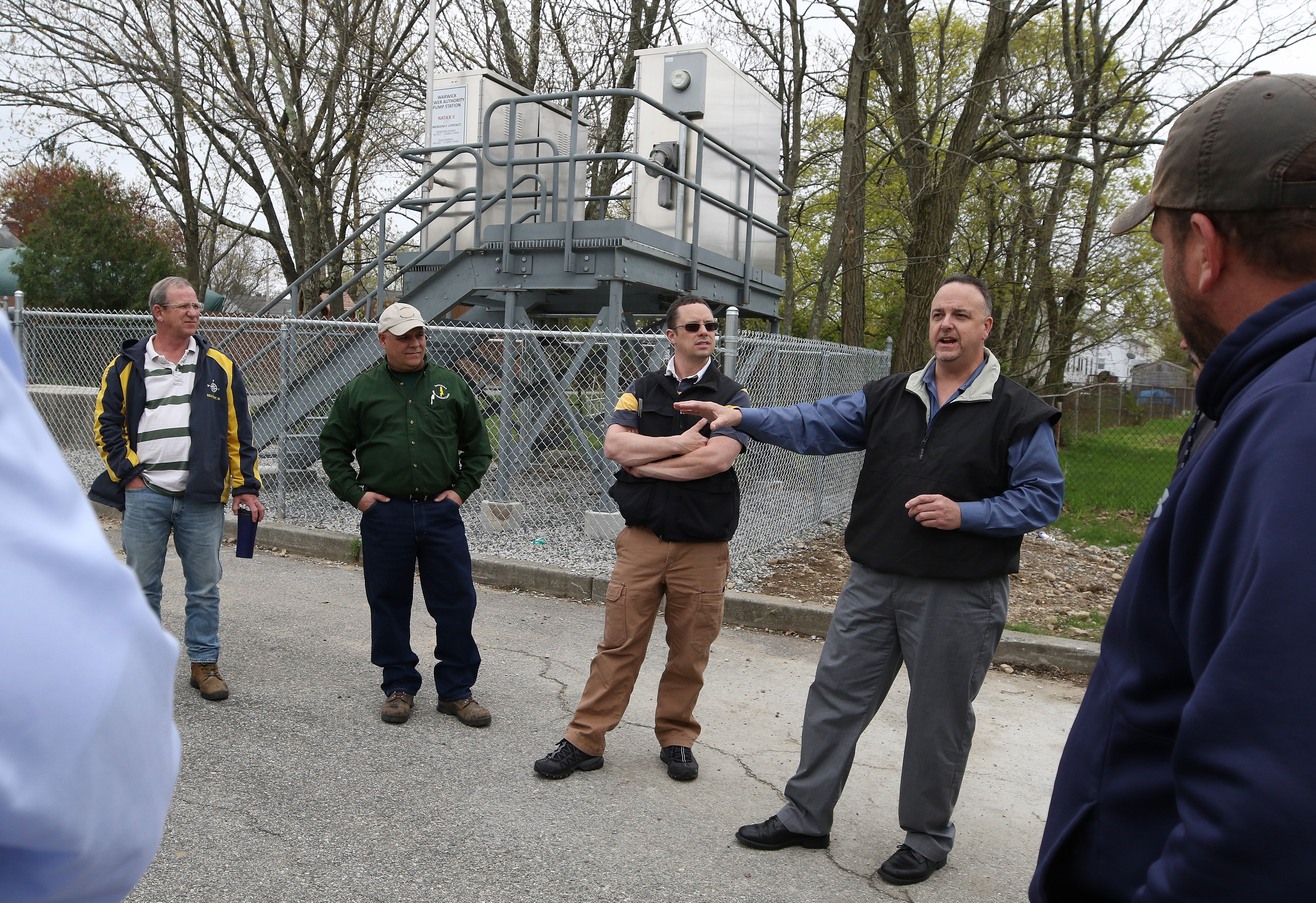
SubscribeIn Warwick, it wasn’t only the treatment plant that failed in the 2010 floods. Six of the city’s 48 pump stations also flooded.
After the training session at the sewer authority, the plant operators are brought out to the Natick II station, which sits next to a public park tucked within a bend of the Pawtuxet. The river isn’t more than a few hundred feet away on three sides, and in 2010 it submerged the neighborhood and the pump station.
At a cost of $230,000, the authority replaced the old structure with a set of submersible pumps and raised all the electrical controls up onto a steel platform that sits about one story off the ground. It’s a relatively simple fix, but it should protect the station and prevent sewage from backing up in the event of extreme weather.
“It will keep on operating if this place ever floods again,” says Earl Bond, project manager for the Warwick Sewer Authority.
Adds John Helwig, a plant operator from West Warwick: “You mean, when it floods again.”
The Providence Journal delivers accurate, timely news about the moments that matter most. Sign up for The Journal's News Alerts newsletter to receive stories like this one in your inbox as soon as they are published.
akuffner@providencejournal.com / (401) 277-7457
On Twitter: @KuffnerAlex