September was another month for the record books across the United States with hotter than normal average temperatures in all but two of the lower 48 states, keeping 2019 on track to be one of the warmest years ever.
This September tied 2015 as the second warmest since records began 125 years ago, the National Oceanic and Atmospheric Administration concluded this week. The warmest September was in 1998.
Overall, climate experts expect 2019 to be one of the warmest years on record. So far this year in the U.S., 2019 ranks third warmest.
The nation’s overall average temperature for September – 68.5 degrees – was 3.7 degrees above the 20th century average, according to NOAA’s National Centers for Environmental Information.
While NOAA is still analyzing global records for the month, the Copernicus Climate Change Service in Europe concluded it was the warmest-ever September in its worldwide records, just edging out 2016.
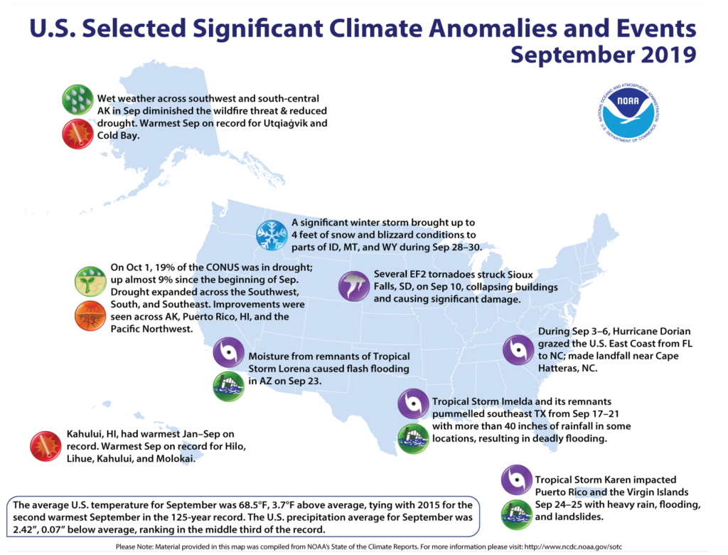
The month will go down as one of the 10 warmest Septembers on record for more than half of the lower 48 states. For Colorado, New Mexico, Texas, Louisiana and Ohio, it was the warmest September ever.
A warming climate
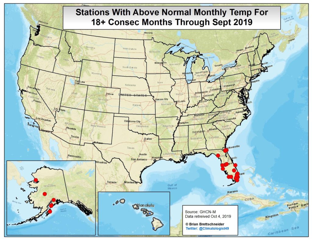
While NOAA’s individual monthly climate summaries don’t make direct statements about the impacts of long-term climate change, they give climate scientists a “look under the hood” for a better understanding of long-term trends, said Brian Brettschneider, a climatologist at the International Arctic Research Center at the University of Alaska Fairbanks.
Those trends, said Brettschneider, are increasingly showing that instead of “starting with a clean slate every month, we’re starting with our thumb on the scale of warmth.”
Across the Southeast, monthly mean temperatures were more than 5 degrees above normal at more than half of the 197 long-term monitoring stations. Of those, 45 either tied or set the record for warmest September.
“We had this really stubborn ridge of high pressure that basically sat over the southern region,” said Sandra Rayne, regional climatologist with the Southeastern Regional Climate Center at the University of North Carolina, Chapel Hill. “The good part of that is it kept tropical systems away, but it was bad because the rain would have been nice.”
That same ridge of high pressure helped funnel tropical moisture up through the Midwest, said Mike Timlin, a regional climatologist for the Midwestern Regional Climate Center. The nine-state region had its second warmest September on record. The region also spanned the gamut on rainfall, with heavy rain in the upper Midwest and too little rain in Kentucky.
Drought and floods
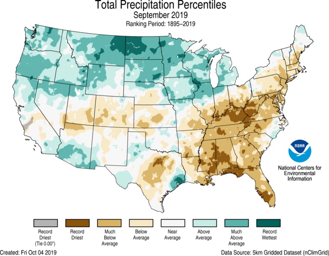
NOAA reported the nine-month period between January and September was the wettest on record across parts of the contiguous U.S. But Kentucky and five other states saw their driest September on record, including Mississippi, Alabama, Georgia, Florida and West Virginia. It was among the top five driest Septembers in five additional states.
High temperatures and lack of rain pushed much of the southeast further into drought. The U.S Drought Monitor reported in early October that almost 80% of the region is experiencing some level of drought conditions.
The heat also continues to have an impact in the Arctic and Alaska, where it was the third warmest September on record.
The National Snow and Ice Data Center at the University of Colorado Boulder reported Arctic sea ice in September averaged 1.67 million square miles. It was the third lowest in 41 years of satellite records. The record low was set in September 2012.
Meanwhile, two tropical events — Tropical Storm Imelda and Hurricane Dorian — were added to the year’s list of weather and climate disaster events with more than $1 billion in losses.
Two other billion-dollar weather events were added, including flooding on the Arkansas River and tornadoes and severe weather in the South and east Arkansas. It marks the fifth year in a row the country has seen at least 10 weather and climate disasters totaling over $1 billion each.
As the tropical systems moved through the Southeast, the number of severe weather reports issued was more than double the median monthly number. For example, 33 tornadoes were reported in North Carolina and three in South Carolina.
Imelda soaked a wide swath of east Texas, including dropping 43.39 inches of rain at North Fork Taylors Bayou in Texas.
Indicative of the changing weather patterns Brettschneider referred to, the close of the month brought a huge winter storm and widespread snow to Idaho, Montana and Wyoming. Babb, Montana, was blanketed by 52 inches of snow.